I summited El Cap, Yosemite’s famous granite monolith, without learning to climb.
Admittedly, backpacking El Capitan is not as epic of a story as ascending the nose. But, it is undeniably an awesome 3 day backpacking trip in Yosemite. + Bonus points are awarded if you run into a real climber (we didn’t).
Curtis and I hiked El Capitan as a 24 mile out and back from the Old Big Oak Flat Trail (near Foresta), camping both nights at Cascade Creek. Instead of the out and back we completed, some hikers can instead choose to make this a thru hike, in similar amount of distance. This hike would traverse from the Old Big Oak Flat trailhead to the bottom of Yosemite Falls. This sounds like a great choice, as long as you don’t mind REALLY STEEP DESCENTS, or shuttling cars around.
Obviously not climbers ;)
Backpacking El Cap, Yosemite
Trailhead: From the Big Oak Flat Entrance station, continue on Big Oak Flat Rd as if you are headed down to Yosemite Valley for 14 miles. The parking for the trail head is on the right with views of Foresta, and has bear bins (no restroom). Map
Distance: My GPS clocks the distance from the trail head to Cascade Creek at 5 miles, then 7 miles from Cascade Creek to El Cap. Approx 24 miles round trip distance.
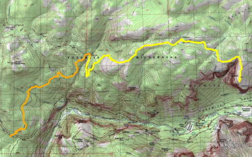
El Capitan Trail Map, orange shows day one and three of our trip, yellow is day two. Click for larger version. PDF download here.
Backpacking El Cap was a spur of the moment choice for what to do with the long Martin Luther King, Jr. Day weekend in mid January. I had originally wanted winter camp that weekend, but due to poor snow accumulations we decided instead take advantage of the cool weather to cross this hike off our to do list.
Hiking during the winter meant we could roll into the Big Oak Flat NPS Ranger Station and complete a self-issue permit for the trip, which is much less of a process than the summer permitting system in Yosemite. Note that because Tioga Pass/Highway 120 is closed past the Tuolumne Grove in the winter, we did not consider starting our hike out of Tamarack Flat. If you are hiking this when the road is open that might be an option.
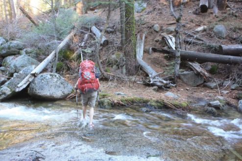
Crossing Tamarack Creek
The Old Big Oak Flat Rd trail snakes past Devil’s Dance floor and Yosemite Valley vistas before entering the forest and crossing a number of ephemeral creeks. We ended up taking our boots off for the crossing at Tamarack Creek, and crossed a over a log at one tributary to Cascade Creek. This was the middle of winter – when there was flow, but not a major amount of runoff. I would have felt pretty uncomfortable at the log crossing if that log had been over-topped by the water.
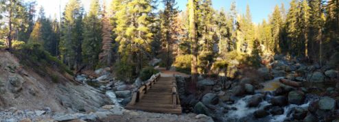
Cascade Creek, along with the accompanying bridge crossing
Cascade Creek has a handful of camping spots – The big one we camped at could hold 3+ tents if needed. The creek is peaceful, but made for a one of our most clammy nights in recent memory. The moisture in the air there was particularly thick near the creek.
Day 2 was the longest hiking day, fourteen miles in order to get out to El Cap and back again. The trail follows the old road grade for three-quarters of a mile before departing to gain 1800 feet in 2 miles. This is the steepest stretch in this hike. It was after this elevation gain that we found, at last, some elusive January snow near Ribbon Creek.
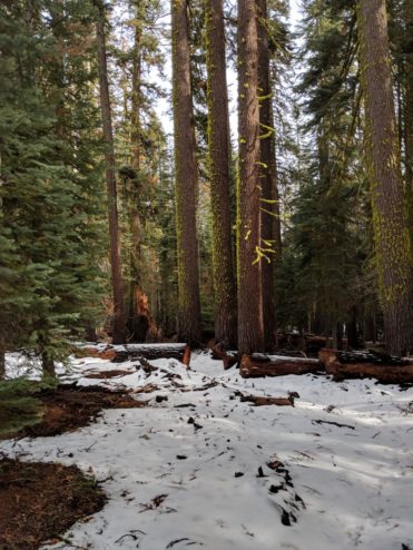
Snow near Ribbon Creek – proof it was actually January at 7000 ft
El Capitan, at this point in the trip, hasn’t been visible since the trailhead. I had hoped the trail would offer some views over the edge of the valley along the way, but no such luck. El Cap does finally come into view as you approach El Capitan Gully and traverse around it onto the granite.
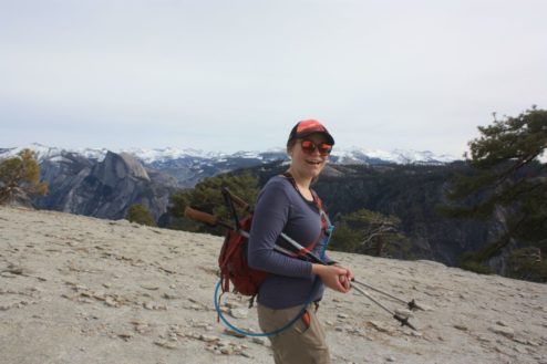
The top of El Cap is a friendly expanse of gently sloping decomposed granite. The summit can be traveled for a long distance without reaching sheer cliffs. We couldn’t find a survey marker, although we did find a suspicious hole that maybe could have been something at some point.
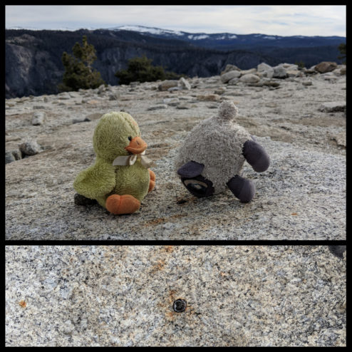
Potential location of previous El Capitan bench mark? Old quad maps don’t necessarily indicate one was here.
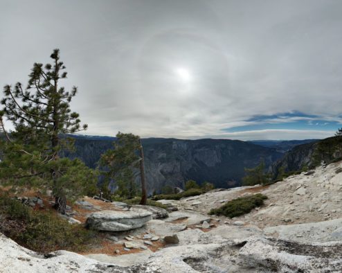
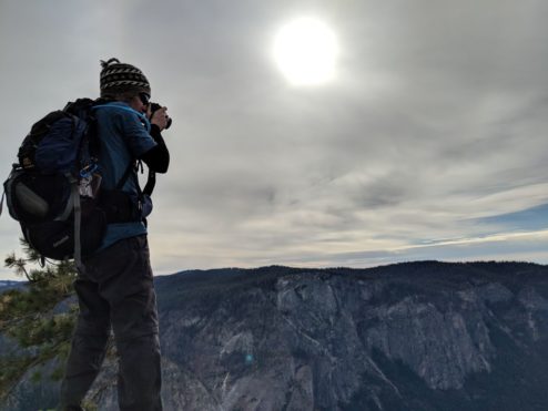
El Capitan, approaching the southern end
Our summit was marked by a strangely cloudy day, that made it a little eerie. Maybe it was just wintertime vibes, but the summit of El Cap was beautiful and quiet, lacking the hustle and bustle that I had come to associate with many valley rim high points like North Dome, Taft Point, Clouds Rest, and Half Dome. It was probably just because it was winter?
Another benefit of winter hiking: Cooler temperatures. It’s getting hot outside now that it is almost July. Currently the creeks are still running – a critical thing to consider when planning your backpack trips on the valley rim in the summer.
More photos in the gallery below:
[See image gallery at beaut-tree.net]


